


GPS Waypoint Finder

GPS Waypoint Finder介绍
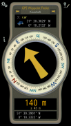
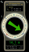
Uses the GPS sensor, Magnetic Field Sensor and Accelerometer to determine the distance and direction to a GPS waypoint. Does not need to be held level. Free & No Ads.
Normally a compass needs to be level to get the correct reading, but this app uses the accelerometer reading to convert the magnetic field reading back to the horizontal plane.
In addition to the direction and distance to the waypoint, a compass ring shows the current heading. North points to True North (i.e. The direction is corrected for the magnetic declination - the difference between magnetic north and true north).
The GPS reading and the time since that reading is shown at the bottom of the screen.
Use for geocaching, finding your car, hotel, or other locations.
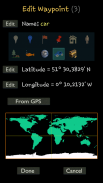
• Store up to 500 waypoints.
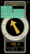
• Imperial or Metric units.
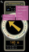
• Import and Export waypoints as GPX files.
Arrow colour changes to green at less than 30m and blue at less than 10m to make it easier for littler ones to identify that they've reached the waypoint.
Whilst walking, look where your going, not at the app or you might trip! The app tells you the direction of your destination, not how to get there.
Only as good as the sensors in your device. Use for Indication Only.
</div> <div jsname="WJz9Hc" style="display:none">使用GPS传感器,磁场传感器和加速度,以确定到GPS导航点的距离和方向。不需要举行的水平。免费和没有广告。
通常一个罗盘需要水平以获得正确的阅读,但这一应用程序使用加速度计读数的磁场读回水平面转换。
除了的方向和距离的航点,一个指南针环显示当前标题。北指向正北(即方向修正的磁偏角 - 磁北与真北之间的差异)。
GPS的读数,以及此后读出时显示在屏幕的底部。
使用寻宝,找到你的车,酒店或其他场所。
•存储多达500个航点。
•英制或公制单位。
•进出口航点为GPX文件。
箭头颜色变为绿色不到30米,蓝色的小于10m,以使它更容易为利特勒的人,以确定他们已经到达航点。
虽然走,看你在哪里去,而不是在应用程序,或者你可能会跳闸!该应用程序会告诉你你的目的地的方向,而不是如何到达那里。
只有不如在设备中的传感器。使用了仅指示。</div> <div class="show-more-end">


